
Rising sea levels could swamp Long Island homes
Rising sea levels could threaten thousands of homes and critical infrastructure on Long Island within a matter of decades.
The homes of 7,000 Long Islanders could be flooded within 35 years, thanks to rising sea levels, according to a new report. Within 100 years, nearly 165,000 Long Islanders could lose their homes as a result of permanent flooding.
Sea levels could rise by around one foot by 2050 — or sooner — and by three feet as early as the 2080s. Early in the next century, sea levels could be six feet higher than they are now, according to the report from the nonprofit research and policy group Regional Plan Association.
Several Long Island communities are considered to be the most at risk, including those along the Great South Bay and South Oyster Bay in the towns of Brookhaven, Islip, Babylon and Hempstead, the report said. A six-foot rise in sea levels could nearly destroy Fire Island.
Compare the maps below to see how rising sea levels could permanently flood various Long Island communities.
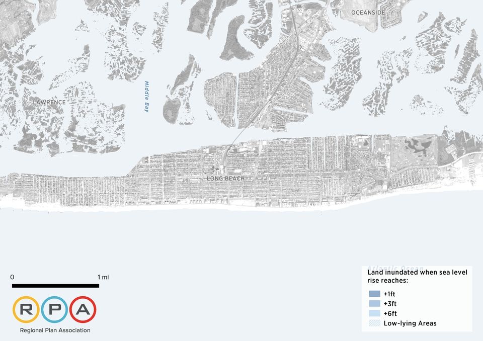
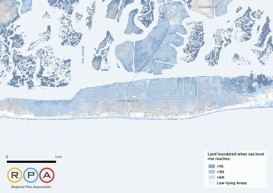
Photo credit: Regional Plan Association
Move the slider — the vertical divider between each set of maps — left or right. Mobile users, the original image will appear stacked on top of the current image.

Photo credit: Regional Plan Association
Photo credit: Newsday / John Paraskevas (Aug. 29, 2013 and Oct. 23, 2014)
Photo credit: Regional Plan Association
Photo credit: Regional Plan Association
Photo credit: Regional Plan Association
Photo credit: Regional Plan Association